You are here
news
Palazzo Mattei
Location
Church of San Benedetto in Piscinula
Location
Flood plaques
A bumpy millennial relationship
Rome’s history runs parallel to that of the river that flows through it, ever since the legendary founding of the city: it was the Tiber perhaps in flood, 28 centuries ago, that carried the basket of Romulus and Remus to the spot where they were found by the she-wolf, at the base of the Palatine Hill. But in the relationship between the Romans and their river, love was never the only feature. It provided a wide range of benefits, no doubts about it, but it was also capricious, irascible and vengeful like any true deity, and as such it could not fail to arouse a certain guarded distrust, even a holy terror. For the repeated floods, first of all, which for more than two thousand years caused sometimes immeasurable damage to the city, exacting a heavy toll of blood and bringing with it, along with the stagnant water, a trail of disease and pestilence.
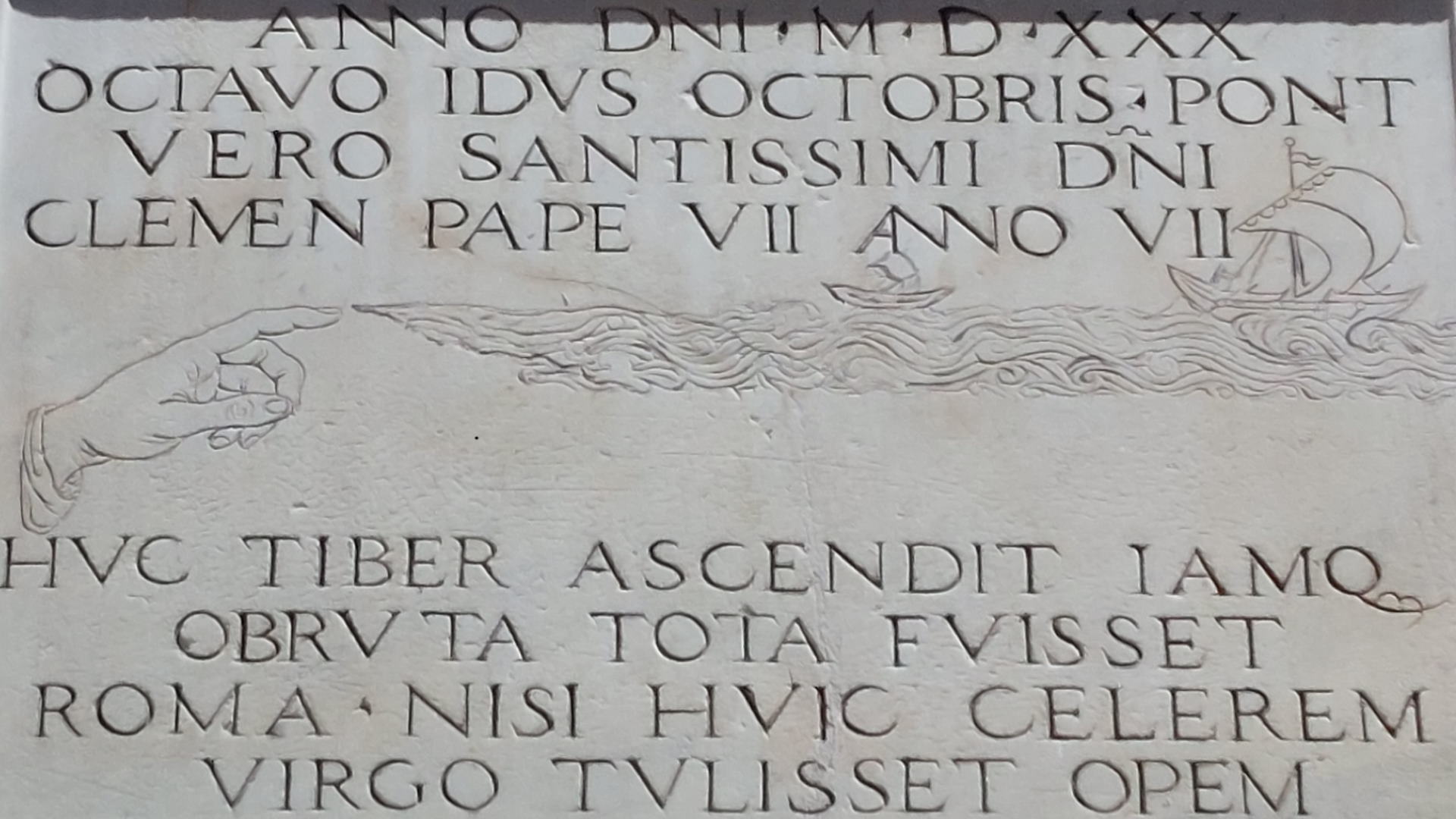
Huc Tiber ascendit
That is, so far the Tiber has risen. When fear gives way to amazement, it is only natural to want to hand down to posterity the exceptional nature of an event, to rewrite the record book. And so, sometimes half-hidden on the walls of churches, in the courtyards of buildings and on street corners, walking in the lowest parts of the city we will come across a large number of old plaques, made of marble or stone, that tell us about the unpredictability of the waters and their violence. More than 120 plaques, most of them preserved, were hung up to the 1930 to commemorate the floods: the simplest ones show only the flood’s month and year while in the most elaborate ones the waters are represented by wavy lines, with a stylized little hand indicating the actual level of the flooding on the wall. The oldest stone record of a flood dates back to 1180 and is engraved on a marble column, now in the Museum of Rome in Palazzo Braschi. Also no longer in its original location is the plaque in Gothic characters currently under a small arch at one end of Arco dei Banchi, once walled on the façade of the church of St Celso e Giuliano, close to Ponte Sant’Angelo: it recalls the flood of November 1277, the year in which floods began to be indicated with reliable and historically verifiable data.
Historical floods
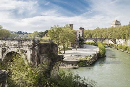
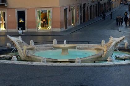
The first plaque that still correctly reports the level reached by flood waters refers to the November 1422 flood and is located on the façade of Santa Maria sopra Minerva. It is in good company because the church, located in one of the lowest areas of the city where the water reached considerable heights, also preserves the memory of the floods of the years 1495, 1530, 1598 and 1870. Between the 15th and 18th centuries, the most devastating one was probably the Christmas flood of 1598, when the floodwaters reached a level of 19.56 meters at Ripetta, a record unsurpassed, submerging the columns of the Pantheon by as much as six meters and causing thousands of deaths. Nine mills were destroyed by the Tiber’s current, which even dragged away the corpses in the tombs of Santa Maria dell’Anima and swallowed three of the six arches of the ancient pons Aemilius, known at the time as Ponte Senatorio and from that day on renamed Ponte Rotto, the Broken Bridge. The damages were such that 12 plaques recall that day, for example at the entrance to Piazza del Popolo, on Via Santa Maria de’ Calderari and on the Lungotevere in Sassia. A further original testimony to the catastrophic flood is the Fountain of the Barcaccia: it is said that Bernini’s source of inspiration was a wreck of a barge dragged on that occasion by the flooding river as far as Piazza di Spagna.
The last roars
The last great floods date back to the 19th century. Plaques in Via dell’Arancio and Via Canova take us back to the 1805 flood, when the river invaded city areas from Ripetta to the Corso, reaching Piazza Navona, the Lungara and the Ghetto. The water also exceeded 16 meters in height on 10 December 1846, as evidenced by the plaque in the underground cemetery of the church of Santa Maria dell’Orazione e Morte on Via Giulia. The most tragic flood, however, was surely the one on 26-29 December 1870, three months after the breach of Porta Pia, when the waters exceeded 17 meters. The violence of the river, attested by some forty simple plaques, the victims and the damage made such an impression that King Victor Emmanuel II came to Rome for the first time and was prompted to adopt remedial measures. Based on a design by Raffaele Canevari, it was thus decided to build high retaining walls: finally finished in 1926, the so-called “muraglioni” walls put an end to the continuous and periodic danger, however, radically altering the entire Tiber environment and destroying unique landscapes and environments such as the ports of Ripetta and Ripa Grande. The last plaque is in the portico of San Bartolomeo all’Isola, decorated with a simple horizontal line and dating back to December 1937: the new walls contained the current and the waters caused only modest flooding.
The river Tiber
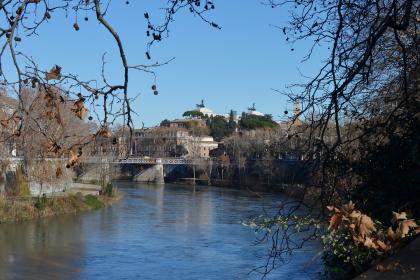
According to legend, the history of Rome begins right here
Pons Aemilius (Ponte Rotto - Broken Bridge)
 Condividi
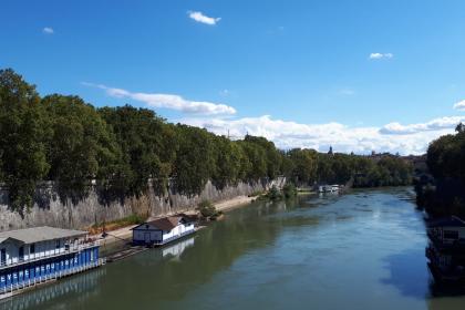
The ancient mills on the Tiber
The Barcaccia Fountain
 Condividi
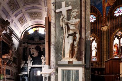
The Basilica of Santa Maria sopra Minerva
 Condividi
Villa Farnesina
Location
Church of San Giorgio in Velabro
Location
Itineraries
Travel Info

Form contatti
[contact-form 5 "Customer Care_EN"]
Credits
ROMA CAPITALE DIPARTIMENTO GRANDI EVENTI, SPORT, TURISMO E MODA
Head of the Department
Patrizia Del Vecchio
Coordination
Francesca Cellamare
Tourism Area Coordinator
Carlo Guarino
Web Manager
Rosario Boccarossa
Social Media Manager
Elisabetta Giuliani
Web Editors
Marina Moretti
Luciana Pelosi
Cristina Ribacchi
Simonetta Salvioni
Social Media Editors
Laura Dal Pont
Pier Paolo Mancuso
Maria Teresa Penserini
Daniele Veroli
IT System Manager
Luca Pavone
Site Creation
Please note: some of the contents of Turismoroma come from the Tourism and Culture database of the city of Rome www.060608.it


