


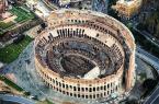


The Alexandrian aqueduct (Aqua Alexandrina) is the last, in chronological order, of the great Roman aqueducts. Built by order of Emperor Alexander Severus in 226 AD. to increase the spas he had built in the Campo Marzio area, the aqueduct was fed with water from the springs located in the locality "Pantano dei Grifi" (today Pantano Borghese). That was a vast marshy area and resurgences, at the foot of the Alban Hills and the Prenestini Mountains, between Via Prenestina and Via Casilina.
The imposing structure unfolded along an initial underground route and then continued upwards, along a distance of approximately 22 km, from the Torre Angela estate, the Vallelunga ditch, the Mistica ditch, the Tor Tre Teste ditch, the Casa Calda ditch, the Casale ditch of Dates, Centocelle and Marranella; it then reached, still elevated, via di Tor Pignattara, to return underground to Porta Maggiore. From here it continued to the Campus Martius, where it ended.
The simple brick curtain arches of which it is made, visible today, have been remodeled several times. In the 3rd-4th century AD. they were relined in brick, thus reconsolidating the original vision of the structure. In this same period, other arches were added to the original ones with pylons, in order to strengthen their resistance. The main restoration interventions date back to the era of Diocletian, between the 3rd and 4th centuries, then between the 5th and 6th centuries and again towards the end of the 8th, by Pope Hadrian I (772-795). In fact, the latter was responsible for the reinforcement of the system through the use of reused blocks of opus quadratum, the restoration of the curtains, again by means of reused materials (tufelli and bricks arranged with a wavy laying surface) and towers.
Photo credts: courtesy of the Capitoline Superintendency
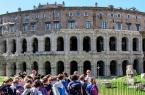
Rione IV - Campo Marzio

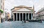
The Pantheon

 Condividi
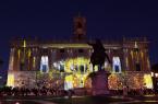
Campo de’ Fiori
 Condividi
Information
Condividi
Locations
To find out about all accessibility services, visit the Rome accessible section.