

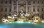

























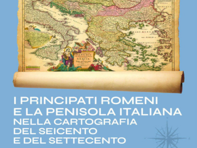
From July 8 to September 13, 2026, the Central Institute for Graphics at Palazzo Poli, a few steps from the Trevi Fountain, will host the exhibition I Principati Romeni e la Penisola italiana nella cartografia del Seicento e del Settecento (The Romanian Principalities and the Italian Peninsula in Seventeenth- and Eighteenth-Century Cartography), dedicated to the cartographic representation of Central and Eastern Europe and its connections with the Italian Peninsula between the 17th and 18th centuries.
The exhibition, held as part of the Romania-Italy Cultural Year 2026, is promoted and organized by the Romanian Embassy in Italy, in collaboration with the Central Institute for Graphics, the Romanian Cultural Institute, the Romanian Institute of Culture and Humanistic Research in Venice, and the Romanian Academy in Rome.
The exhibition presents a fascinating journey through 17th- and 18th-century European cartography, comparing representations of the Romanian Principalities of Wallachia, Moldavia, and Transylvania with those of the Italian Peninsula and the ancient pre-unification states. The maps on display document not only territories, borders, rivers, cities, and routes, but also power relations, frontier areas, political balances, diplomatic and cultural relations, and the manifold exchanges between different European states. From this perspective, the Romanian Principalities, a crossroads between the Ottoman Empire, the Habsburg world, the Danubian area, and Western Europe, emerge as strategic and cultural spaces fully integrated into European history.
The exhibition brings together works by great cartographers and engravers active between the seventeenth and eighteenth centuries, from the principal European schools: Dutch, Italian, French, German, and Austrian. Among the artists represented are Gerardus Mercator, Willem Blaeu, Johannes Janssonius, Nicolas Sanson, Frederik de Wit, Giacomo Cantelli da Vignola, Nicolas de Fer, Johann Baptist Homann, Matthäus Seutter, Guillaume Delisle, Antonio Zatta, Bartolomeo Borghi, and Franz Johann Joseph von Reilly. The exhibition also features original copperplate engravings, often hand-watercolorized at the time, which combine geographical rigor, graphic elegance, and historical-documentary value. Among the most valuable works are Giacomo Cantelli da Vignola's Descritione delli Principati della Moldavia e Valachia (Description of the Principalities of Moldavia and Wallachia), published in Rome in 1686 by Giovanni Giacomo De Rossi, and several maps of the Danube, Transylvania, Wallachia, Moldavia, the Black Sea region, and the Italian Peninsula. The exhibition also showcases the heritage of the Central Institute for Graphics, whose collections contain important examples of cartography and travel literature. Alongside maps of the Romanian Principalities and Italy, the exhibition features significant works such as the Veduta di Roma (View of Rome) from the 1493 Liber Chronicarum, Franz Schott's Guide to Italy, De Rossi's (Mercurio Geografico) Mercury Geographicus, and Giovanni Maria Cassini's Nuovo Atlante Geografico Universale (New Universal Geographical Atlas).
Through all the works, the exhibition conveys the richness of a historical period in which cartography was not only a tool for geographical knowledge, but also a political, cultural, and diplomatic language. The maps on display narrate territories, borders, routes, relationships, and worldviews, offering the public the opportunity to rediscover the relationship between the Romanian Principalities and Italy from a European perspective.
Photo: official poster of the exhibition
Informationen
Da mercoledì 8 luglio a domenica 13 settembre 2026
Inaugurazione martedì 7 luglio alle ore 19.00. Segue vin d’honneur.
 Condividi